Keelung River Bicycle Trail

Photo:amo

Photo:amo

Photo:amo

Photo:amo

Photo:amo

Photo:amo

Photo:amo

Photo:amo

Photo:amo

Photo:amo

Photo:amo

Photo:amo

Photo:amo

Photo:amo

Photo:amo

Photo:amo

Photo:amo

Photo:amo

Photo:amo

Photo:amo

Photo:amo

Photo:amo

Photo:amo

Photo:amo

Photo:amo

Photo:amo

Photo:amo

Photo:amo

Photo:amo

Photo:amo

Photo:amo

Photo:amo

Photo:amo

Photo:amo

Photo:amo

Photo:amo

Photo:amo

Photo:amo

Photo:amo

Photo:amo

Photo:amo

Photo:amo

Photo:amo

Photo:amo

Photo:amo
Photo:amo
Photo:amo
Photo:amo
Photo:amo
Photo:amo
Photo:amo
Photo:amo
Photo:amo
Photo:amo
Photo:amo
Photo:amo
Photo:amo
Photo:amo
Photo:amo
Photo:amo
Photo:amo
Photo:amo
Photo:amo
Photo:amo
Photo:amo
Photo:amo
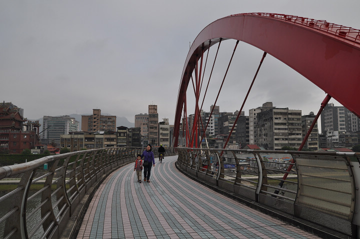
After the river channel straightening, Keelung River is no longer a source of flooding area. Now it has been transformed into a several riverside parks, and the bicycle trails. The bicycle trails separated into left and right banks of the Keelung River, and it can be accessed from the Lin An-Tai (No. 10) Evacuation Gate. The total distance of right riverside and left riverside bike path is 22.2km and approximately 90 minutes to complete the whole route. There are guide signs along the way which briefly introducing the history of the Keelung River. The section of the bike route between Dazhi Bridge and Zhongshan Bridge is quite remarkable with bountiful ecology and worth to visit. In the evening, you can also enjoy the spectacular water and light show at the “Fountain of Hope” at the Dajia Riverside Park.

The Left Riverside Route: Dajia Riverside Park-> Yingfeng Riverside Park-> Chengmei Left Riverside Park-> Nanhu Left Riverside Park
The Right Riverside Route: Nanhu Right Riverside Park-> Chengmei Right Riverside Park-> Rainbow Riverside Park-> Neihu Sports Park-> Meiti Riverside Park

Nearby attractions: Lin Antai Historical Home, Taipei Story House, Taipei Confucius Temple, Taipei Fine Arts Museum, Shilin Night Market, Raohe St. Night Market


scenery features:

1.Length: Left bank: 18.1km; Right bank: 17.6km.
2.Riding time: Left bank (incl. 5.1km along the water) 75 mins. Right bank 70 mins. The two trails connect at Dazhi Bridge.

Directions:

Public: MRT Station:
1. Left Bank: From Yuanshan Station (Danshui Line), head towards Minzu E. Rd. and Xinsheng N. Rd. and cross the culvert under the Sun Yat-sen Expressway.
2. Right Bank: From Danshui Station (Danshui Line), take the No. 21 or 247 bus to Mingshui Rd. or Dazhi Pump Station.

By Bus
To Left Bank: Take the No. 72, 222, or Brown 16 to Dajia Elementary School Station and enter from the Lin An-tai (No. 10) Evacuation Gate; or take the No. 262, 307, 505, 604, or Blue 10 to Zhuangjing Neighborhood or Fuyuan Pump Station and enter from the Tayou Evacuation Gate.
To Right Bank: Take the No. 28 or 256 to Mingshui Rd. 3 or Dazhi Pump Station; the No. 28, 284, Brown 1, or Blue 20 to Chenggong Bridge; or the No. 21,51,53, 203, 240, 247,281,620,645,toNanhu High school station

Near Hotels

Hey Bear Hostel

3.2 km
8F., No.1, Sec. 2, Chongxin Rd., Sanchong Dist., New Taipei City 241, Taiwan
TWD630+

Citizen Hotel

4.1 km
No.80, Sec. 1, Jinshan S. Rd., Zhongzheng Dist., Taipei City 100, Taiwan (R.O.C.)
TWD3,500+

Chyuan Du Spring Resort

7.5 km
No.220, Guangming Rd., Beitou District, Taipei City , Taiwan
TWD2,500+

Beitou Hot Spring Resort

7.5 km
No.3, Zhongshan Rd., Beitou Dist., Taipei City 112, Taiwan
TWD4,030+

Ya-Go River Lodge

13.5 km
No.36, Xuefu Rd., Tamsui Dist., New Taipei City 251, Taiwan
TWD1,950+

Near Attractions

Lin Antai Historical Home

Dajia Riverside Park

Taipei Story House

Taipei Expo Park-Xinsheng Park Area

Taipei Fine Arts Museum

Taipei Children's Recreation Center

The Martyr's Shrine

The Grand Hotel Taipei

Taipei Expo Park-Yuanshan Park Area

Xingtian Temple